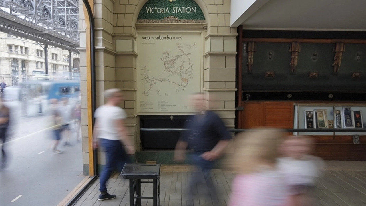
A window into 1899—and how it was saved
Two hand-painted ceramic rail maps, installed in 1899 and long concealed behind phone booths and then a newsstand, have been restored at London’s Grade II listed Victoria Station. The work brings back to life a prominent feature of the old London, Brighton & South Coast Railway entrance, designed in a Renaissance revival style at the turn of the 20th century.
Govia Thameslink Railway managed the project, with funding from Network Rail and a grant from the Railway Heritage Trust. Conservation specialists from Restore London led the painstaking on-site cleaning, while historic tile maker Craven Dunnill Jackfield repaired broken tiles and surrounding stone. The team removed surface grime, stabilized hairline cracks, matched glazes for missing sections, and reset displaced pieces so the panels read as one continuous design again.
The maps sat in public view for only a short stretch of their 125-year life. Early telephone booths obscured them, followed by a mid-century newsstand that hid much of the work. When the panels were uncovered more recently, time and fittings had damaged the surfaces. This restoration reverses decades of wear and puts the artwork back in the daily path of commuters and visitors.
The timing is no accident. The unveiling coincides with nationwide events marking 200 years since the dawn of the modern railway in Britain—an anniversary tied to the 1825 opening of the Stockton & Darlington Railway. A new blue heritage plaque now sits by the maps, quietly stating how and why this piece of station history was saved.
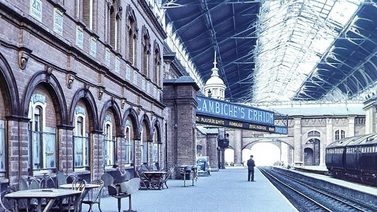
Victoria Station itself grew in stages. One side opened for the London, Brighton & South Coast Railway in 1860; the other, for the London, Chatham and Dover Railway in 1862. The wall between them vanished after the 1923 Grouping brought both companies under Southern Railway, but the layered architecture stayed, which is why features like these panels still sit in plain sight—if you know where to look.
What the maps show—and why it matters
The two panels tell different stories. One illustrates the full reach of the London, Brighton & South Coast Railway at its peak, stretching from London down to the Sussex coast and across to key seaside towns. The other zooms in on suburban routes that once fed the capital from growing communities to the south. Many of the stations painted here vanished long ago, especially after mid-20th-century rationalisation, so the maps double as a roll call of lost stops.
They are not just diagrams. They are faience artworks—glazed ceramic, hand-lettered, and set into a grand architectural surround as part of a broader station front and hotel extension led by the railway’s chief engineer Sir Charles Langbridge Morgan and architect C. D. Collins. The materials were chosen to handle soot, steam, and London’s weather, but a century of fixtures and neglect still took its toll.
Restoring ceramic like this means more than a scrub. Conservators first survey every tile, photograph damage, and test clean small patches to see how old glazes react. They remove later adhesives and grime, fill losses with compatible materials, and colour-match infills so repairs blend without pretending to be original. Stonework around the panels gets its own careful treatment to prevent future moisture and movement from harming the tiles again.
The project also sets a template for how to care for heritage in busy transport hubs. Victoria handles huge daily footfall, so the team had to work around passenger flows, with protection screens, out-of-hours tasks, and approvals tied to the station’s listed status. The result keeps the panels robust enough for a public space without stripping away the character that makes them valuable.
Why does this matter now? Because these panels pin the modern network to its roots. You can stand in a 21st-century concourse and see how a Victorian railway imagined its world—how it branded its reach, which towns it prized, and how suburban growth was already reshaping travel. For regular passengers, it’s a rare chance to read a map that doesn’t change with a timetable update.
There’s also a practical upside. With the restoration done, the station can use the panels as a touchpoint for education and tours, and it can plan maintenance rather than emergency patch-ups. GTR, Network Rail, and the Railway Heritage Trust often collaborate on smaller conservation jobs; here, the visibility is higher, and the lesson is clear: if you bring heritage back into daily life, people notice.
Key facts at a glance:
- Location: Victoria Station, Grade II listed, London
- Date of original installation: 1899, as part of LB&SCR’s grand entrance
- Project lead: Govia Thameslink Railway; funders include Network Rail and the Railway Heritage Trust
- Conservation: Restore London (cleaning and stabilisation); Craven Dunnill Jackfield (tile and stone repairs)
- Commemoration: Blue heritage plaque unveiled on site
As a piece of craft, the panels show meticulous hand-lettering and glazing you rarely see today. As a piece of London, they reconnect the station to its split origins and to the era when railway companies built big to make a statement. And as a piece of storytelling, the Victorian rail maps now do what they were meant to do: help you picture the network at a glance, then look a little longer.